
NHS vs Private Blood Tests: What’s the Difference?
NHS vs private blood tests explained: compare costs, speed, access, accuracy, result interpretation, follow-up and when each option makes sense in the UK.
THE CAR PARK, HIGH STREET, STONEHOUSE, GL10 2NG
This profile is currently based on public provider data. Claim it to add your logo, description, services, opening hours, website, public email and useful contact details so patients see clearer, more complete information.
Approximate location based on published coordinates.
This page shows the published details for STONEHOUSE HEALTH CENTRE, an NHS hospital in Stonehouse (Stroud), GL10 2NG. Use the map for directions and explore nearby providers using the location links.
Fresh, practical articles for readers and patients.
NHS vs private blood tests explained: compare costs, speed, access, accuracy, result interpretation, follow-up and when each option makes sense in the UK.

Corporate vs individual health insurance explained: what employer cover includes, taxable benefits, family cover, policy limits, gaps to check and when personal cover may help.
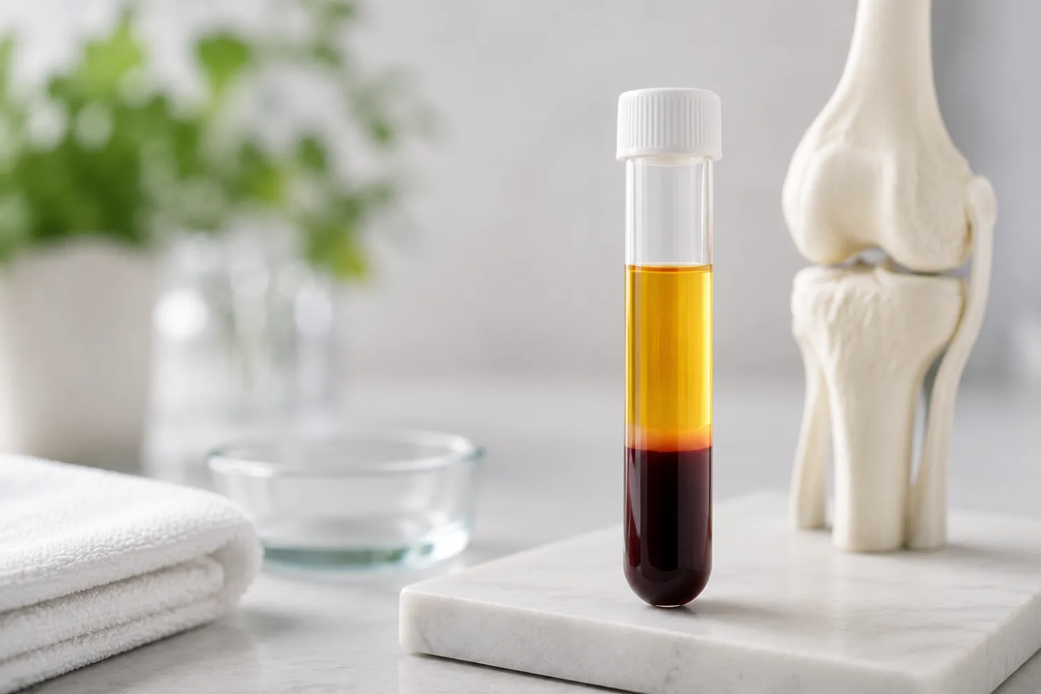
PRP therapy in the UK explained: how platelet-rich plasma treatment works, what evidence says, costs, safety, side effects, clinic questions and red flags.
Reach people searching for UK GPs, dentists and care homes through relevant sponsor placements, homepage visibility and sponsored healthcare articles.
Appear across GP articles, NHS GP practice pages, location pages, private clinic discovery and homepage sponsor sections.
£500/month · billed monthly
Includes 2 sponsored articles per month.
Reach visitors viewing dental articles, NHS dentist listings, location dentist pages and private dental clinic profiles.
£500/month · billed monthly
Includes 2 sponsored articles per month.
Be visible across care home articles, NHS care home listings, location pages and private care home discovery.
£500/month · billed monthly
Includes 2 sponsored articles per month.
Advertise to 1,400+ daily healthcare searchers
Sponsorships from £500/mo
Reach 1,400+ daily healthcare searchers
Category sponsorships from £500/month